top of page


Navigating Waters & 3D Data: Mobile Mapping on a Boat with the ROCK R3 Pro LiDAR
LiDAR Mobile Mapping on a Boat with the ROCK R3 Pro
2 min read
405


Easily convert LAS to LAZ and view your point cloud in the field with ROCK Desktop (Free Download!)
We’re excited to launch ROCK Desktop, a free point cloud converter and visualizer. It converts your LAS files to LAZ files...
3 min read
1,374


Case Study: Using ROCK LiDAR to Inspect Power Lines Across California
How did Surefire approach this extensive power line inspection project? One drone LiDAR flight at a time.
4 min read
919


Case Study: Drone Services Provider Navigates a 2,500-Acre Gold Mine Site in Fiji with ROCK LiDAR
Kahuto Pacific was hired by a Canadian mining company to provide topographic, aerial LiDAR for a 2,500-acre (1,000-hectare) property.
5 min read
1,939


GCP Best Practices for Aerial Surveying Projects
Ground Control Points (GCPs) are a crucial part of aerial surveying. They help make sure the data collected is as precise as possible.
3 min read
895


Case Study: Construction Company Saves $300k by Updating Contours with ROCK Cloud
Here's the top-level takeaway: Companies and contractors can save a significant amount of money in Construction and Earthworks projects.
4 min read
560


3 Types of Contours — Which Option is Best for your Surveying Project?
Nearly every land surveying project needs updated, accurate contours. Whether you’re moving dirt, pouring concrete or measuring terrain.
2 min read
561


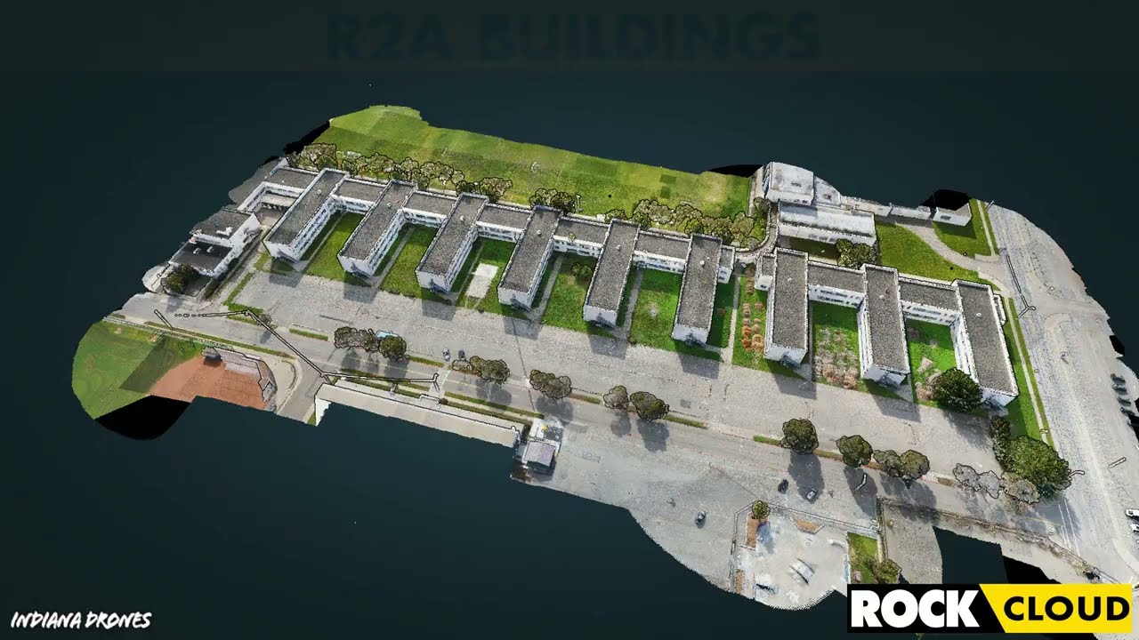
Get 1.65 cm Accuracy Results with the ROCK R2A Drone LiDAR & ROCK Cloud 3D Data Processing Software
ROCK Robotic's R2A LiDAR with the ROCK Cloud processing software can produce 1.65 cm accuracy! Bold statement, I know. So, let me break...
5 min read
3,393


Improving Accuracy of DJI Zenmuse L1 with ROCK Cloud 3D LiDAR Data Processing Software
Aerial Drone LiDAR has never been more accessible. The new wave of LiDAR hardware spans a large price and quality range. In order to address
4 min read
3,777
Turn your LiDAR data into stunning animations using the ROCK Cloud.
It just keeps getting better! We absolutely love this new Drone LiDAR 3D Mapped dataset. Now you can easily export videos of your LiDAR...
1 min read
699


Four Crews? Four Weeks? Forget that! ROCK can help get the job done in one day.
We received amazing feedback from one of our ROCK Cloud users. He had nothing but great things to say about our LiDAR processing software.
1 min read
263
bottom of page