Energy & Utilities
Capture, process, and deliver corridor analytics at scale
Capture, process, and deliver corridor analytics at scale—with repeatable accuracy and industry compliance.
Three ways utilities use ROCK
Vegetation management
Automate the detection of vegetation encroachment along transmission and distribution corridors. Classify growth zones by proximity to conductors, prioritize trimming, and track changes over time.
Clearances & sag
Measure conductor‑to‑ground, conductor‑to‑structure, and mid‑span clearances with repeatable precision. Monitor thermal sag under varying load and temperature conditions.
PLS‑CADD Deliverables
Export ready‑to‑load terrain, structure, and conductor models for engineering design, maintenance planning, and compliance reporting.
Recommended workflow
Capture corridor LiDAR with UAV (ROCK Ultra or R3 Pro V2) or mobile mapping along alignment.
Field‑check in ROCK Desktop to confirm coverage and alignment quality.
Process in ROCK Cloud — align to control, classify assets and vegetation, and compute clearances.
Export PLS‑CADD deliverables and generate compliance/maintenance reports.
Typical deliverables
- Ground‑classified point cloud (LAS/LAZ)
- DTM/DEM & breaklines
- Structure models with attachment points
- Conductor geometry with sag/tension details
- Clearance envelope analysis (to ground, structure, vegetation)
- Vegetation encroachment maps with height and proximity classifications
- Planimetric linework for roads, fences, waterways, access paths
- Orthomosaic & colorized LiDAR for visual inspection
- File formats: PLS‑CADD XML, DWG/DXF, LandXML, SHP/GPKG, GeoTIFF, CSV.
Capture solutions for utilities
Aerial LiDAR (UAV)
- ROCK Ultra – fly higher and capture longer spans, even in dense canopy.
- R3 Pro V2 – detailed capture for high‑resolution structure and terrain mapping.
Mobile mapping
- ROCK Mobile Mount – vehicle or hi‑rail‑based collection for distribution networks and substations.
Positioning & control
- ROCK Base + RTK Network – triple‑band GNSS, NTRIP corrections, and RINEX for PPK processing.
Why utilities choose ROCK
Survey‑grade accuracy: meets utility engineering tolerances for structure placement, sag, and clearance.
High‑speed acquisition: map miles of corridor per day from UAV or vehicle platforms.
Turnkey deliverables: directly usable in PLS‑CADD, GIS, and CAD without rework.
Vegetation intelligence: AI/ML classification for encroachment detection and growth forecasting.
Reduced crew exposure: minimize time in energized or difficult‑to‑access zones.
Use cases
FAQs
Can you match our PLS-CADD template?
Yes—deliverables can be formatted to your company’s specifications.
What vegetation classification standards do you follow?
We align with NERC FAC-003 and can customize to regional utility requirements.
Can you work under energized lines?
Yes—UAV and vehicle mapping allow capture from safe distances without line shutdowns.
How do you prove accuracy?
We supply PPK/RTK stats, alignment checks, and independent check-shot residuals.
Do you offer change detection over time?
Yes—ROCK Cloud can compare datasets and highlight growth, encroachment, and clearance changes.
Knowledge for Energy & Utilities
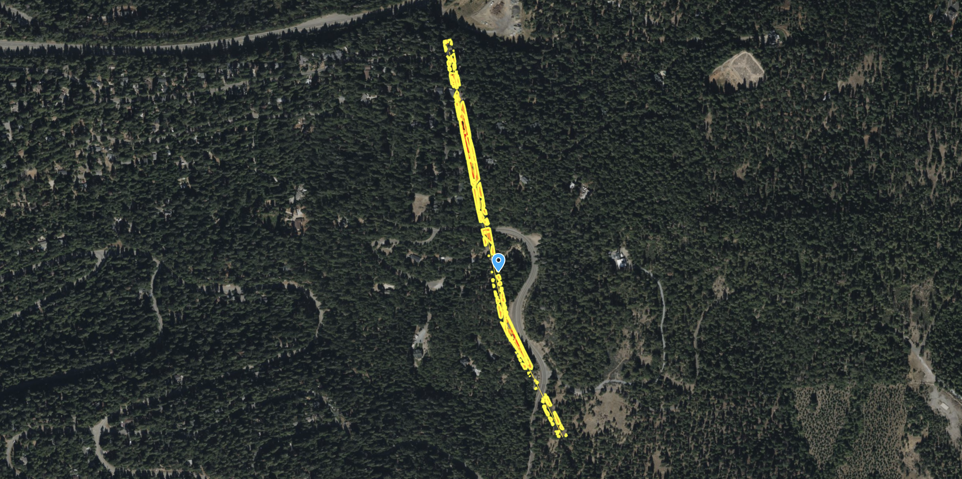
ROCK Ultra – Van Bibber Creek (120m, 5 m/s)
Testing the ROCK Ultra’s canopy penetration and ground detail capture at Van Bibber Creek.

R3 V2 Van Bibber Creek
Showing off the R3 Vegetation Penetration.
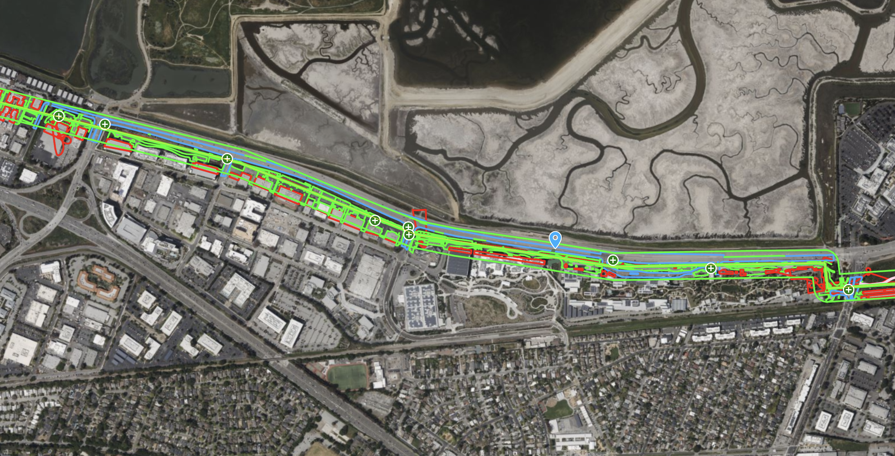
ROCK R3 Pro – High-Density Transmission Corridor Survey for PLS-CADD
See the ROCK R3 Pro capture a 111-acre transmission corridor at an incredible density, delivering 4.3 cm RMS accuracy for demanding PLS-CADD engineering workflows.
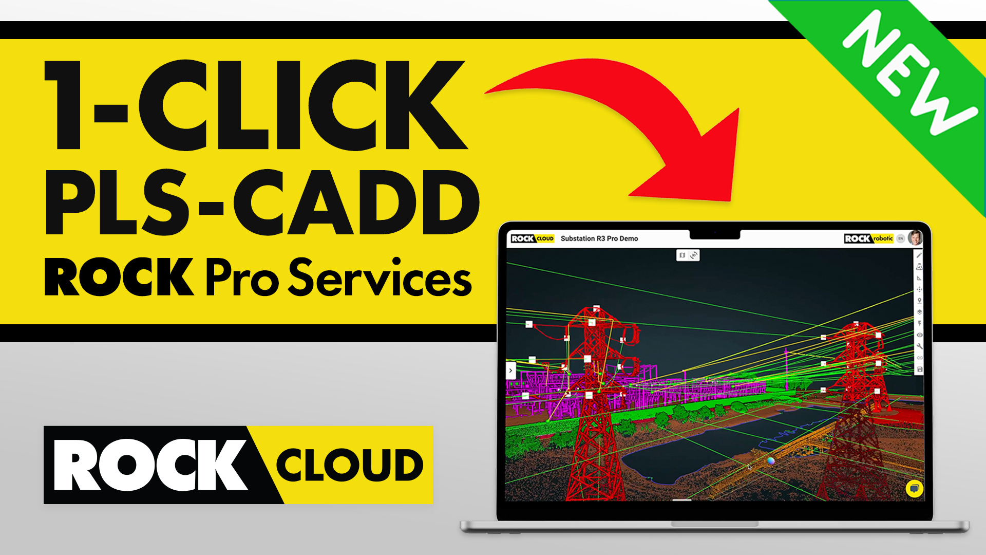
Power Line Surveying & Management Made Effortless with ROCK Pro Services for PLS-CADD
Power Line Surveying and Management Made Effortless with ROCK Processing Services for PLS-CADD.
ROCK R3 Pro V2 – High-Accuracy LiDAR Survey in Dense Georgia Vegetation
Discover how the ROCK R3 Pro V2 achieved survey-grade accuracy of 0.089 ft RMS on a 37-acre site with dense vegetation, validated by a registered survey firm.
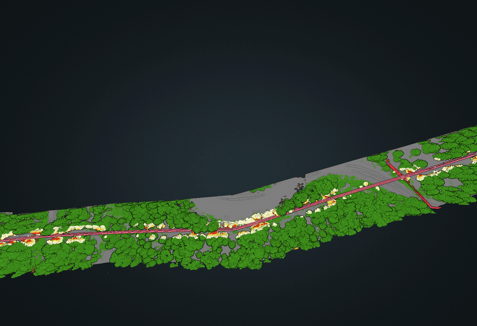
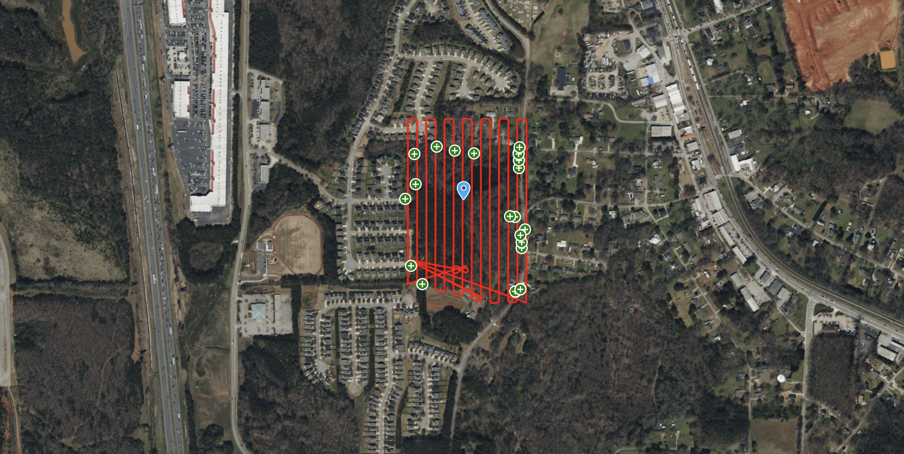
ROCK R3 Pro – Powerline Corridor & Vegetation Management
See how the ROCK R3 Pro and ROCK Vegetation Management service identified 712 vegetation encroachments along a 23-acre powerline corridor, providing actionable data for utility companies.
Try ROCK Robotic now
Your 3D scanning journey starts here. Download ROCK Desktop or process in ROCK Cloud.